
I arrived home an hour before lunch after a fun-filled, four-hour Sunday bike ride with my MTB Gang in the midst of the mountain of Tubao, La Union. It has been a while since the last time I had an MTB exploration on parts of mountains that cows and carabaos are the only vehicular means. That experience kindled a very familiar feeling when I had my first climb at Mt. Pulag and on that same day, a strong urge to relive the thrill and anxiety of hiking quickly formed flesh and so Trek Mt. Ulap soon became a certain itinerary for my next Sunday.
 Several choices were shortlisted after reading blogs and consulting friends who have achieved various conquers of different land masses. Considering that I am not a seasoned trekker (my last hike was three years ago) I opted to take a “leisure” day-hike of Mt. Ulap. I thought it was easy.
Mt. Ulap sits proudly at the domain of Itogon, Benguet. Benguet, as all of us know, is famous for its majestic mountains and terrains. Clad in pine trees, enveloped by cool-crisp winds, in an altitude of down-to-earth people – this place always holds a very special place in my heart. While tourists busy the lovely places of Baguio, Mines View, Strawberry Farm, etc. (too many to mention), during weekends, crowds of hikers are expected to dominate various trails. For beginners or seasoned hikers, the mountains of Benguet are always a terrific option!
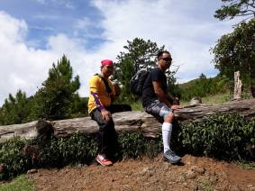
It took me one single text message to your Uncle JC, my favorite cousin – my childhood best-friend, and my partner in our seemingly childish and foolish adventures – to persuade him to accompany me with yet another out-of-the-blue modest escapade. Trekking Mt. Ulap is best shared with people close to you. You must do so. Unfortunately, my other friends had their personal commitments that time your mom was two-month pregnant with your younger bro/sis (not sure yet) so they were not able to partake in the occasion. JC arrived at our home early night before the schedule. A bit of bonding moments over brandy until drunkenness kicked in (as we always do every time we get together), we called it a night past 11 so to wake up revitalized three o’clock the next morning. Revitalized, yeah, it was a bad idea. We, however, managed to leave at 4:30am. Huh!
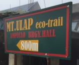
 It took us an hour-drive from La Union to Baguio; I used my car since I had a heads-up that parking area is available at the registration area. It took us another hour from Baguio to Ampucao Barangay Hall where the registration area is located. Google map came in handy as it served as my guide from Baguio to Ampucao Barangay Hall. On our way to the barangay hall, we were greeted by waves of hikers on their way to start trekking. Although I had made our pre-registration through Mt. Ulap’s official facebook account, where one has to accomplish a google form, I got anxious thinking that it might waste us a lot of time for registration alone due to the large number of visitors. At 6:30am, we arrived at the registration area at the barangay’s covered basketball court beside the elementary school. A friendly local immediately approached me and assisted where to initially park. I then went straight to the registration table where I saw a lady sat in front of the desk enlisting hikers whose names fill one page of a notebook in two columns!
I asked the lady on the registration, although busy filling out forms she turned to me and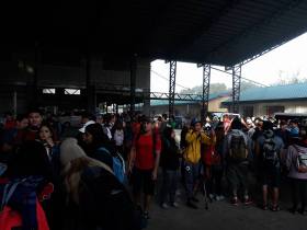 sent a genuine, warm smile. Registration for two, please. She brushed aside the papers she was working on then brought out a fresh form, scribbled on it, asked my name and told me the fees: Php 600 for the guide, and Php 100 registration fee for each person. She also asked if we need a parking space, she handed a small piece of paper, Php 50 for parking. Hilda, our guide, was introduced to us and she gave us a
 one-minute orientation. And, that’s it, in less than 10 minutes, we’re set to go! As we approach our car to get our things for the hike, the same lovely registration lady approached us and told us that there’s a better parking slot near the trek start point. I think she likes me, nah! Don’t worry; it’s ok to say that, your mom won’t believe me anyway on such wishful thinking as she often refers. Now with our guide in the car, we headed
 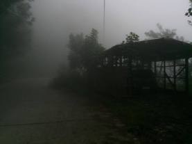 to the drop-off point. Hilda spoke with the owner of the sari-sari store just in front of the jump off point and we had our private, covered, fenced, and secured parking hut beside Manang Rita’s store. I wasn’t expecting that at all. The registration lady has been really kind and generous to us! Alas, I failed to get her name and gave my sincerest of gratitude. Really, that’s all I’d do!
 JC complained at the start of the hike, around 50 meters of cemented road angled steeply. After it, our first rest. Then, the mountain bared its beauty after several assaults. The opening trek, I can say, is quite challenging for beginners. While I belong to the “beginner” class, the initial trek was actually fun, I owe it to my MTB rides and daily squats of 50 to 100 two weeks ago, my
 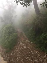 legs gifted me enough strength to bask in the glory of Mt. Ulap!
Our guide, Hilda, has been generous with her stories keeping us “at home” all the way. She said, years ago, being a guide served as a good source of income for the locals as there were only several of them. But now, with the decline in the number of visitors since the tourism agency had put a limit on the number of hikers to be allowed each day, and with the increase of number of guides, a guide could serve visitors once a day (day-hike) as compared to 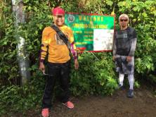 twice a day in the golden days and visitors are normally abound only during weekends and holidays. It is not, however, because of the increase-decrease stuff that made me consider giving an additional pay for Hilda (which by the way, giving tip to hike guides has been a custom for me), her kindness is genuine. And trust me, all the locals are.
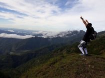
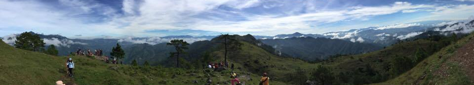
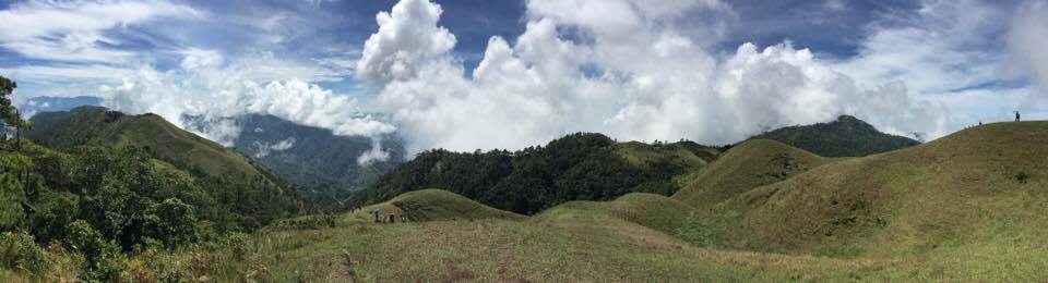
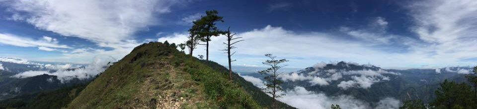
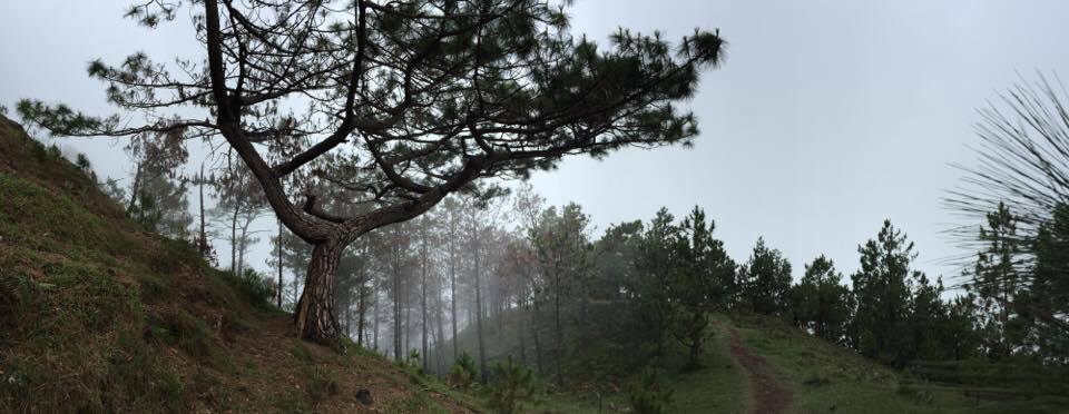
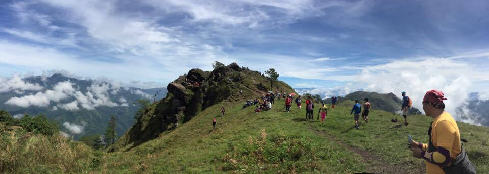
It was a fine day! The sun was up and the sky blue. Pausing for pictures is a must to keep documents of the moments and, of course, to provide rest for our complaining legs. Walking under towering pine trees, the scent fresh and regenerating, while staring at mountain tops and ridges, waves of clouds appeared to be kissing the mountains and blowing energy to its visitors, sharing its wonders as they commune with nature. I wish you were here.
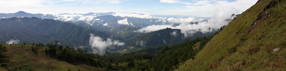
I wished for rain. The heat of the sun was bearable, it was gentle yet piercing. Sunscreen is a necessity; we have none. Hilda, had her umbrella. Unfair! It’s always fun to trek under the rain, a wish that sadly was not granted as we trekked the three peaks of the Ampucao – Sta. Fe Ridge: Ambanaw Paway (1788 MASL, 3.6 km), Gungal Rock (1814 MASL, 5.4 km), and Mt. Ulap (1846 MASL, 6.5 km). Overnight camp is also allowed. We travelled light, with a liter of water up to the peak (a store sells water on the descent), dressed in shirt and trekking shoes, and some choco bars and raincoat in our small bags.
I have seen pictures of people posing atop the famous Gungal Rock. Your Uncle and I, of course, did not let go of the opportunity to have our share of the hype. We reached Gungal with hikers populating the surroundings. First come, first serve to have pictures taken, and the guides are who manage the line-up. But I have realized that custom after we had our photo ops. Upon reaching the rock, I and JC jumped in straight to the rock waiting impatiently for a group of eight individually taking turns to be with the rock. I apologize. Not knowing that there was a waiting list, our luck, which I think is brought by the registration lady and our guide, Hilda, stepped in again. An elderly gently disciplined the pasaways and respectfully asked them to stay behind but we were not told to do so, instead he allowed us to stay there waiting and already taking pictures. Here, I have heard some visitors bad mouthed, complaining of their guide not prioritizing them, talking back to the elderly and other guides. Shame! These guys do not, and I repeat, do not deserve to be there. Such arrogance is plain disrespect to the locals and to her majesty. You must not be like them!
For I may have behaved out of the keeping, knowingly or unknowingly, I apologize.
We experienced more steep slopes from Gungal to Mt. Ulap, more grueling but the astounding scenery is just… simply… beautiful!
Not much to do at the peak, only a few could enjoy catching their breath while under the shade of some bushes. We seized the opportunity for taking pictures with us in the background and pictures of the view without us blotting it. Half an hour before the clock struck 12, we enjoyed our lunch at the “mini-stop”, a local’s food and souvenir shop. Having rested for 30 minutes, we started to trek down Sta. Fe. I must say, the descent is much more difficult than the ascent! Almost half of the way, may be less but that’s how it appeared to me, are what seemed to be endless stairs. This was where JC has to use two tungkods as Hilda laughed at our jokes about how “expert” climbers we are. After the stairway from heaven, the remaining of the path was like a stroll in the park. In the end, we bade farewell to Hilda and thanked her for her assistance. A jeepney was waiting to be filled with passengers; we stuck ourselves in while some opted to savor the 50-peso ride back to Ampucao sat on top of the jeep which sped and cruised its way amidst the thick, zero visibility, fog. Our nap was disturbed when the jeep stopped in front of a store, and I realized that Hilda must have advised the driver to where he should drop us. And so it ended, we traveled back to La Union where you and your mama cheerfully welcomed us back alive.
We were tired; nevertheless, fulfilled.
August 08, 2017
Hope these could be of help…
- 4-6 hours day-hike trek, there’s an option for overnight camp (additional fees, tents can be rented)
- Difficulty: Mild (that’s just me saying)
- Fees: 600 guide, 100/head registration, 50 parking
- Cellphone signal is sporadic (I had Globe)
- Reserve through Mt. Ulap’s FB account, although walk-in is allowed
- A liter of water is fine for the ascent, there’s a store which provisions can be bought after the peak
- Trekking shoes prove a huge difference in comfort as compared to training shoes
- Travel light, shirt and shorts are fine for a day-hike (just bring along a raincoat and a not-so-thick jacket just in case, but don’t exaggerate)
- Bring sunscreen or umbrella (but umbrella is baduy)
- Edible wild berries along the way, lots of fruit-bearing tress on the descent (suha & bayabas, pick for free!) but best to ask your guide before devouring any fruits, berries, leaves, or grass along the way if they will not put you in trouble
- Great place! Carpe diem!

Leave a comment